Cadastre : Bâtiments
Cette couche de polygones contient les bâtiments qui figurent sur le plan cadastral.
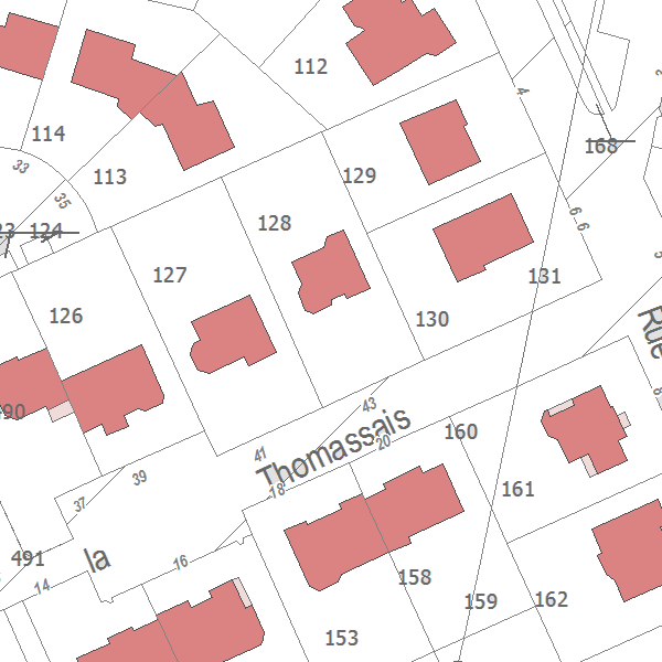
Les bâtiments sont figurés par leur emprise au sol.
Il est possible de distinguer les bâtiments légers et les bâtiments en dur.
Simple
- Alternate title
- 


                              bâtiments du cadastre 
- Alternate title
- 


                              cadastre_qgis.geo_batiment 
- Date (Creation)
- 2014-03-01
- Date (Revision)
- 2019-08-01
- Citation identifier
- https://public.sig.rennesmetropole.fr/geonetwork/srv/fre/xml.metadata.get?uuid=ca06a7f1-1704-4177-9826-5d40cdf08175
- Status
- Completed
- Point of contact
- 
                            Organisation name Individual name Electronic mail address Role Rennes Métropole - Service Information Géographique Service Information Géographique Point of contact Centre des finances publiques Centre des impôts foncier de Rennes - Pole Topographie et Gestion Cadastrale Owner 
- Maintenance and update frequency
- Quarterly
- Maintenance note
- 


                              Pour plus de détails, voir la métadonnée parente (uuid = 903dea6a-fc33-4eb7-b652-a29476a9a0eb). 
- 
                            
                              
                              GEMET - INSPIRE themes, version 1.1 
- 
                            - 
                                  
                                    
                                    Bâtiments 
 
- 


- 
                            
                              
                              GEMET 
- 
                            - 
                                  
                                    
                                    cadastre 
- 
                                  
                                    
                                    cadastre 
- 
                                  
                                    
                                    bâtiment 
 
- 


- 
                            
                              
                              GéoBretagne v 2.0 
- 
                            - 
                                  
                                    
                                    référentiels : cadastre 
 
- 


- 
                            
                              
                              RM Diffusion v 1.2 
- 
                            - 
                                  
                                    
                                    diffusion restreinte 
 
- 


- Use limitation
- 


                              Réutilisation libre sous réserve de la mention obligatoire se trouvant sur la métadonnées parente (uuid = 903dea6a-fc33-4eb7-b652-a29476a9a0eb). 
- Access constraints
- Other restrictions
- Use constraints
- License
- Other constraints
- 


                              Pas de restriction d’accès public 
- Distance
- 10 m
- Language
- Français
- Character set
- UTF8
- Topic category
- 
                            - Planning cadastre
 
)) 
                        - Reference system identifier
- RGF93 / CC48 (EPSG:3948)
- Topology level
- Abstract
- Geometric object type
- Surface
- Distribution format
- 
                            Name Version GML 3.2.1 EDIGEO 2013 
- OnLine resource
- 
                            Protocol Linkage Name OGC:WMS https://public.sig.rennesmetropole.fr/geoserver/ows?service=wms&request=GetCapabilities ref_cad:batiment OGC:WFS https://public.sig.rennesmetropole.fr/geoserver/ows?service=wfs&request=GetCapabilities ref_cad:batiment 
- Hierarchy level
- Dataset
Conformance result
- Date (Publication)
- 2013-12-10
- Explanation
- 


                                  non testé 
- Pass
- No
- Statement
- 


                              Se reporter à la métadonnées parente (uuid = 903dea6a-fc33-4eb7-b652-a29476a9a0eb) pour plus de précision. 
Metadata
- File identifier
- ca06a7f1-1704-4177-9826-5d40cdf08175 XML
- Metadata language
- Français
- Character set
- UTF8
- Parent identifier
- 


                                Cadastre disponible sur Rennes Métropole (juin 2024)
                              
                              
                              903dea6a-fc33-4eb7-b652-a29476a9a0eb 
- Hierarchy level
- Dataset
- Date stamp
- 2023-08-08T12:35:48
- Metadata standard name
- 


                              ISO 19115:2003/19139 
- Metadata standard version
- 


                              1.0 
- Metadata author
- 
                            Organisation name Individual name Electronic mail address Role Rennes Métropole Frédéric CHAUVIN - Service Information Géographique Point of contact 
Overviews
 
                  Spatial extent
)) 
                  Provided by
